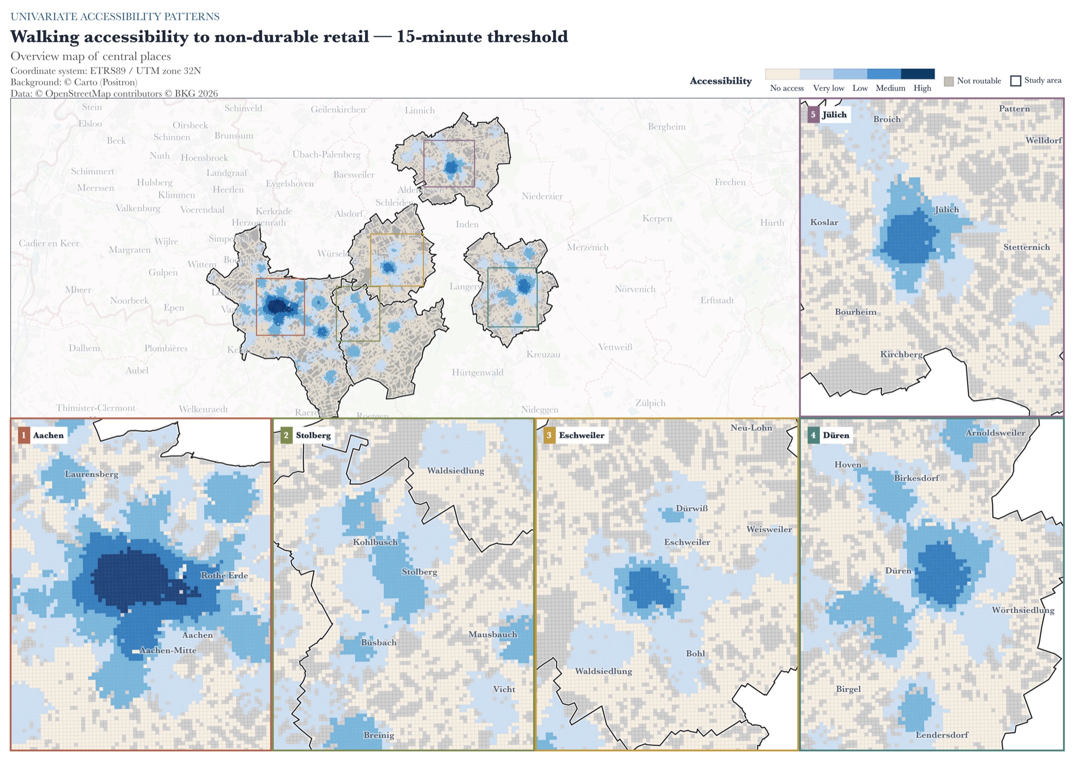
01 / Research
How accessible is everyday retail?
Five cities. Four transport modes. A reproducible study of retail access and spatial inequality.
Python · PostGIS · r5pyRead case study ↗
GIS ANALYST · MUNICH, GERMANY
GIS Analyst at Plan4Better. I make geospatial data useful for mobility, accessibility and urban planning.
SELECTED WORK
01 / Research
Five cities. Four transport modes. A reproducible study of retail access and spatial inequality.
Python · PostGIS · r5pyRead case study ↗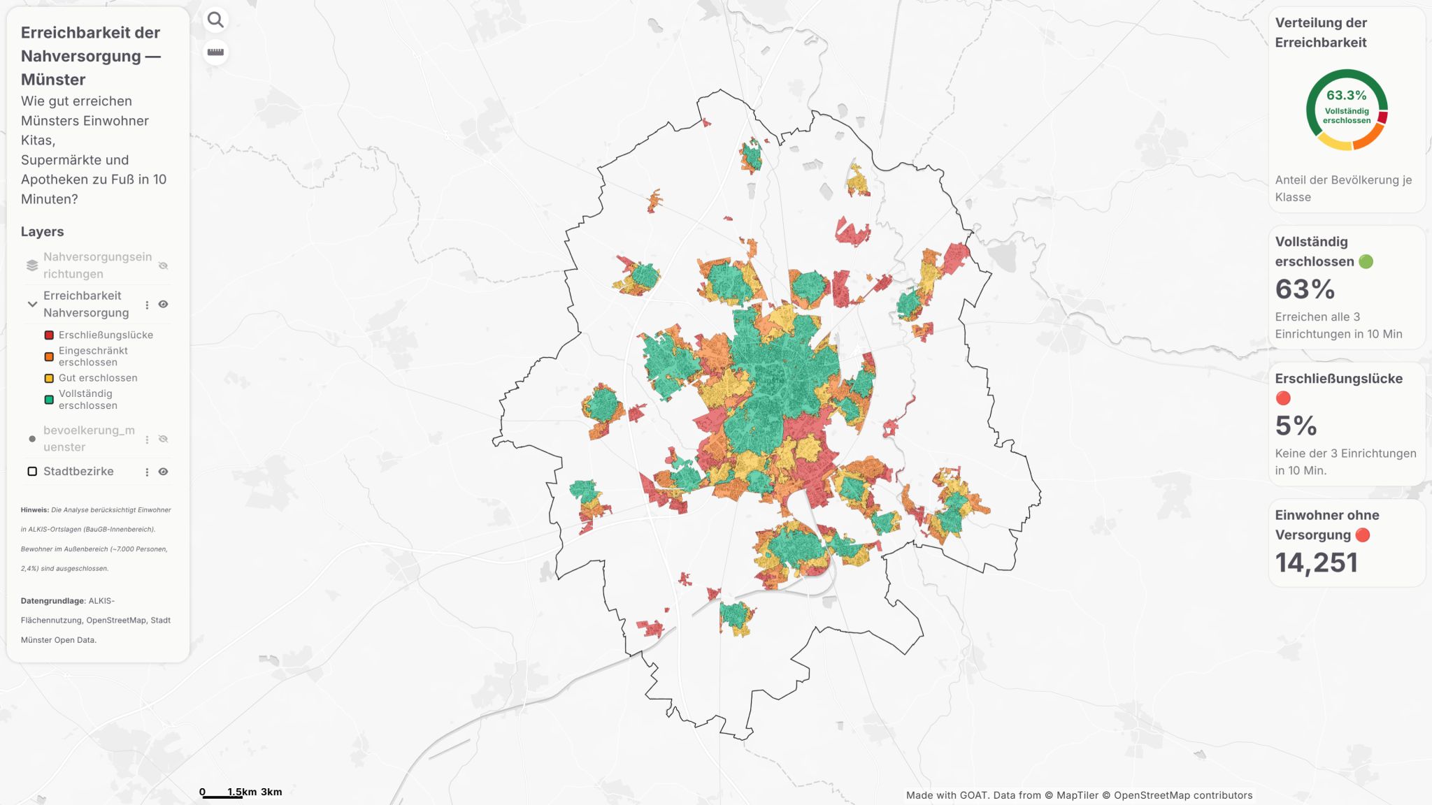
02 / Planning
A Münster accessibility dashboard identifying 14,251 residents without walkable basic supply.
GOAT · AccessibilityRead case study ↗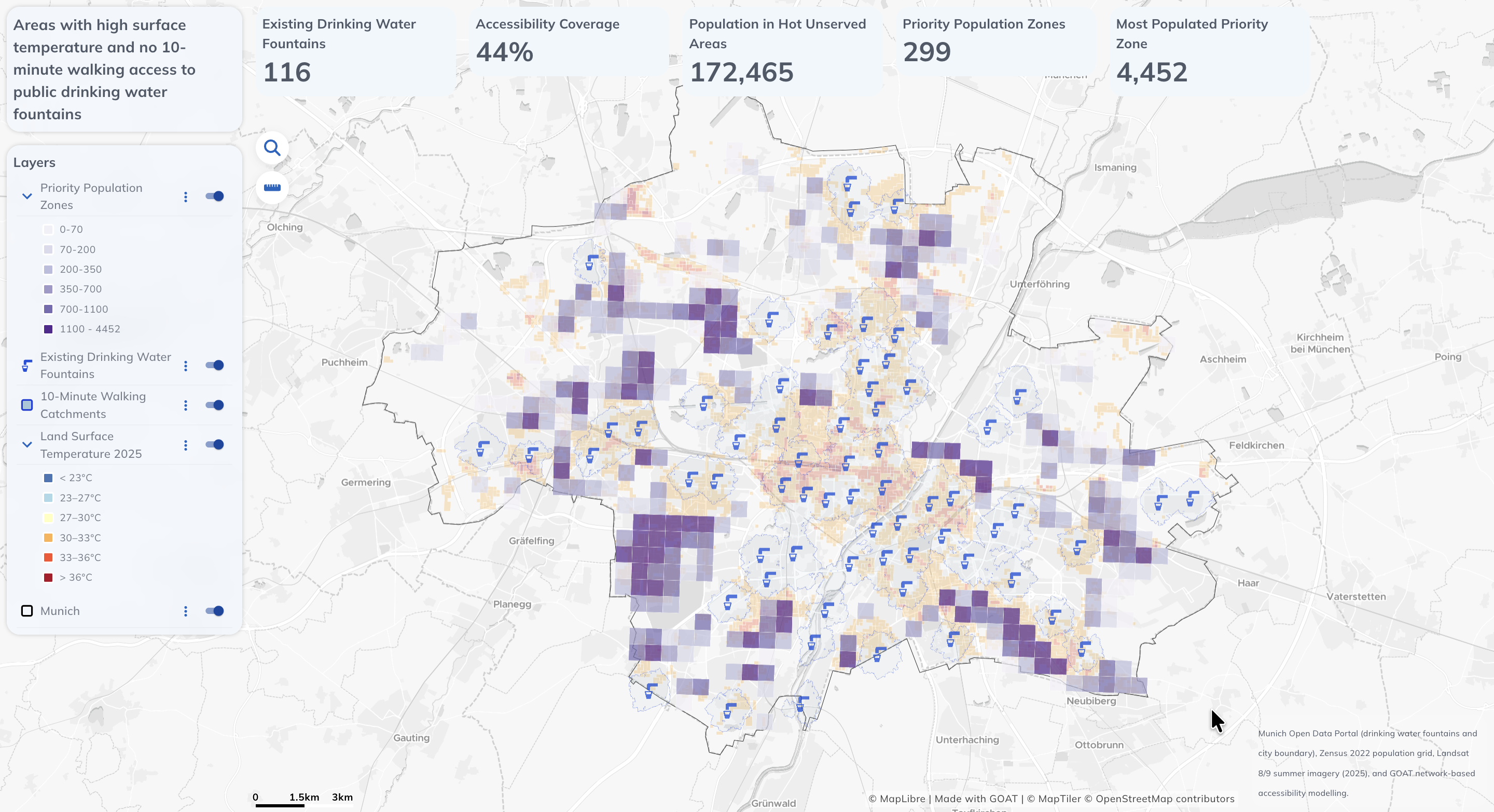
03 / CLIMATE & PLANNING
Accessibility, surface temperature and population data identify 299 priority zones for new public drinking fountains.
GOAT · Accessibility · Climate adaptationRead case study ↗TOOLS & METHODS
MY APPROACH
A connected workflow.
Select a step to explore.
Step 01 / 04
Bring together open geodata, public transport timetables and population datasets.
OpenStreetMap · GTFS · Zensus
Step 02 / 04
Clean geometries, join spatial datasets and build reproducible processing pipelines.
PostGIS · Python · GDAL
Step 03 / 04
Calculate travel times, compare accessibility and identify gaps in local services.
r5py · GOAT · GeoPandas
Step 04 / 04
Create clear maps, interactive dashboards and reports that support planning decisions.
QGIS · GOAT · Cartography
WHAT I BRING
Accessibility, walkability and network-based indicators for mobility and urban planning.
Spatial SQL queries, data preparation and reproducible pipelines with PostGIS, Python and GDAL.
My QGIS plugins →Thematic maps, considered map design and interactive dashboards that communicate spatial findings clearly.
A LITTLE ABOUT ME
Based in Munich, I work at Plan4Better on GIS analysis for mobility and planning projects. I completed my MSc in Transport Engineering and Mobility at RWTH Aachen in July 2026.
Experience & educationMy Plan4Better project contributions →