Overview
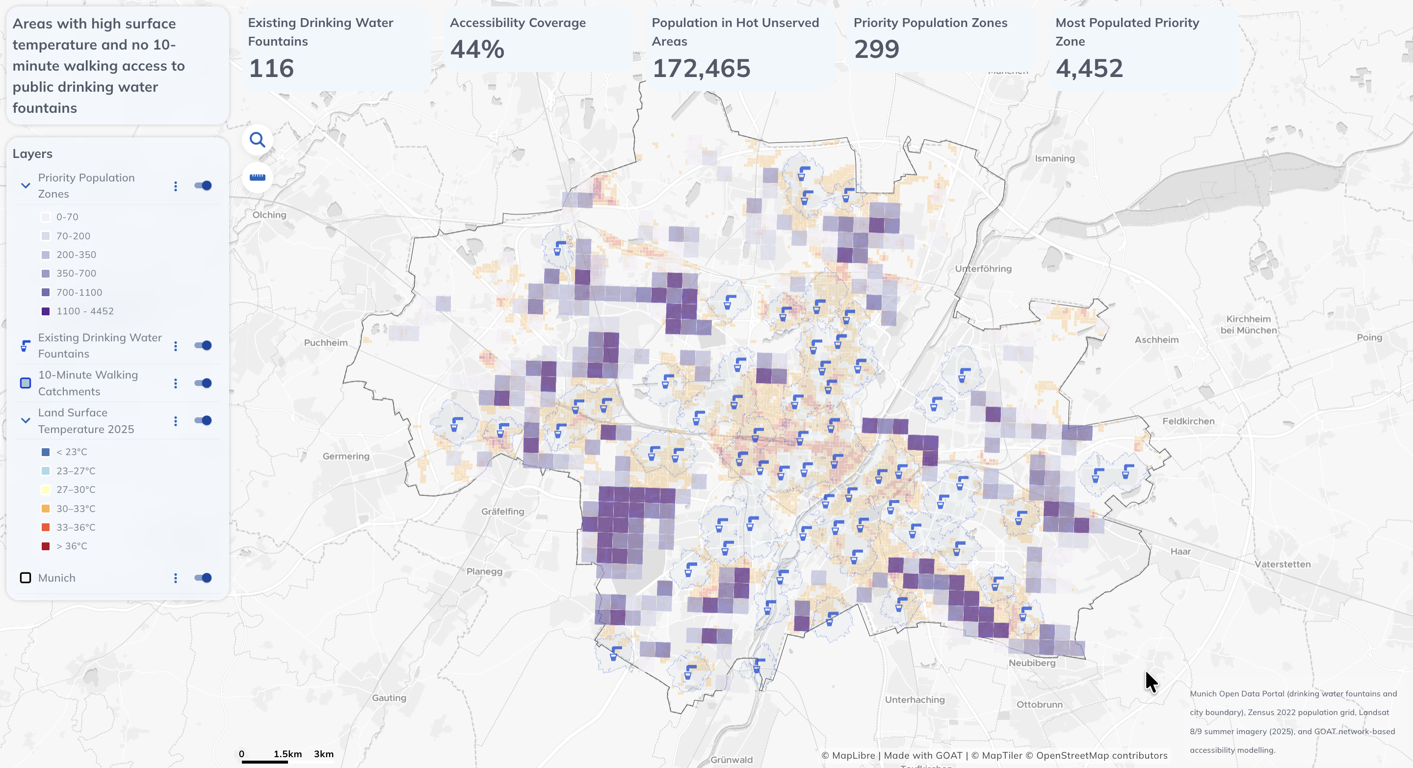
With summer temperatures rising across Europe, this project explores a practical urban planning question: where should new public drinking water fountains be located? Using GOAT (Plan4Better), I combined open data on Munich's existing 116 public drinking water fountains with network-based walking catchments, population data, and 2025 satellite-derived land surface temperatures to identify where infrastructure gaps have the greatest impact on residents.
Key Numbers
- 116 existing public drinking water fountains in Munich (Landeshauptstadt München)
- 44 % of Munich's population within a 10-minute walking catchment of a fountain
- 299 priority zones identified for new infrastructure
- 172,465 residents in priority zones with combined heat exposure and accessibility gaps
Methodology
Existing Fountain Network
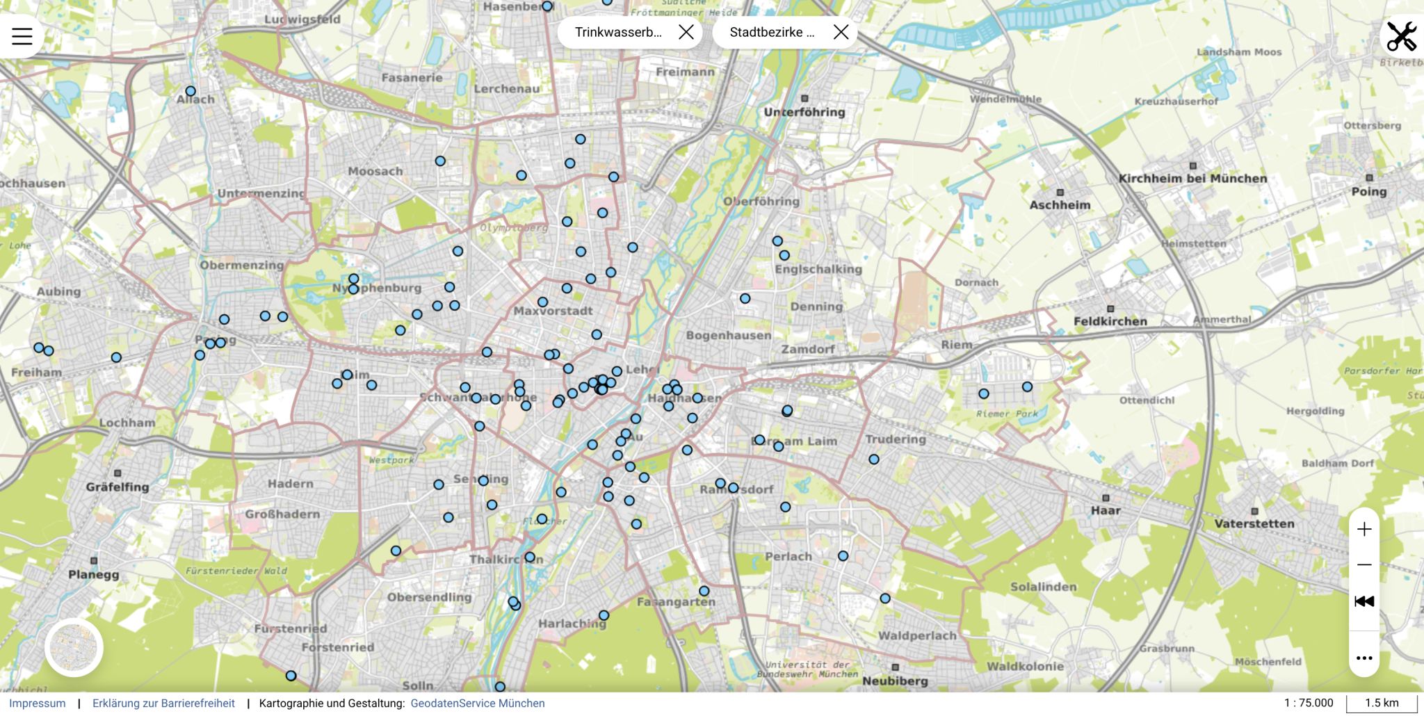
Loaded the official dataset of 116 public drinking water fountains from Landeshauptstadt München as the baseline layer, providing a current picture of where infrastructure already exists across the city.
Network-Based Walking Catchments
Generated 10-minute walking catchments for each fountain using GOAT's network-based accessibility analysis — revealing that only 44 % of Munich's population currently lives within walking reach of a public fountain.
Heat Exposure Layer
Integrated 2025 land surface temperature (LST) data derived from satellite imagery to identify areas where outdoor heat exposure is highest, flagging zones where a fountain would have the greatest public health benefit.
Priority Zone Identification
Combined population density, heat exposure (LST > 30 °C), and accessibility gaps to identify 299 priority zones — areas where new drinking water infrastructure would serve the most heat-exposed residents currently outside any walking catchment.
Tools & Technologies
- GOAT (Plan4Better) — network-based accessibility analysis, interactive dashboard
- Landeshauptstadt München open data — public drinking fountain locations
- Land Surface Temperature (LST) 2025 — satellite-derived heat exposure
- Population density data — for prioritisation of underserved zones
Outcome
Transformed raw open data into a planning tool that shows not just where fountains exist, but where they are missing the most — combining heat stress and population density to give city planners a clear, evidence-based picture of where new drinking water infrastructure would have the greatest impact on residents' quality of life during hot summers.