Mode-Specific Retail Accessibility




RWTH Aachen University · completed July 2026 · thesis grade 1.3
Evaluation of Mode-Specific Retail Accessibility in Selected German Cities
I evaluated how many retail destinations residents can reach by walking, cycling, public transport and car, and how those patterns overlap with socioeconomic structure.
Research question
How is retail accessibility distributed across neighbourhoods and socioeconomic groups, and do systematic spatial inequalities appear when the same places are evaluated by different transport modes?
Analysis workflow
Follow the process. Expand a step for the details.
01Retail destinations
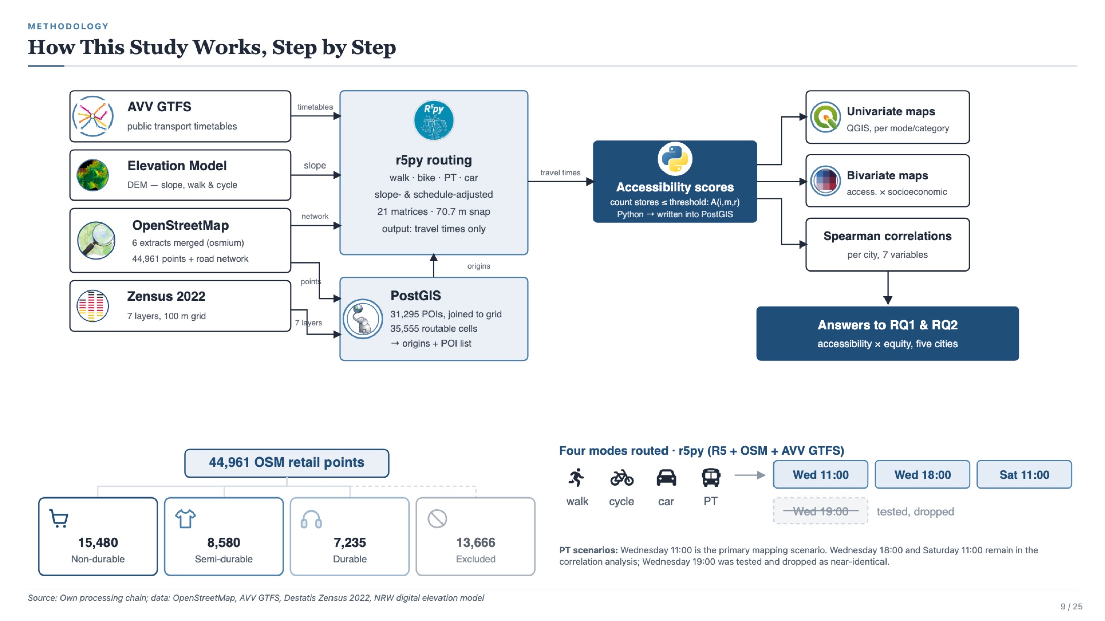
Classified 44,961 OpenStreetMap retail points into non-durable, semi-durable and durable goods: 15,480, 8,580 and 7,235 destinations respectively.
02Analysis grid
Used a cumulative-opportunity measure on the 100 m Zensus 2022 grid. The study area contains 51,062 cells, with 35,555 routable cells used consistently for cross-mode comparisons.
03Travel-time routing
Computed travel-time matrices with r5py and the R5 routing engine. Public transport used the AVV GTFS feed alongside the OSM network.
04Statistics & maps
Processed the data in PostgreSQL/PostGIS and Python, then used Spearman correlations and QGIS bivariate choropleths to examine socioeconomic patterns.
What the analysis shows
Walking access is centre-concentrated
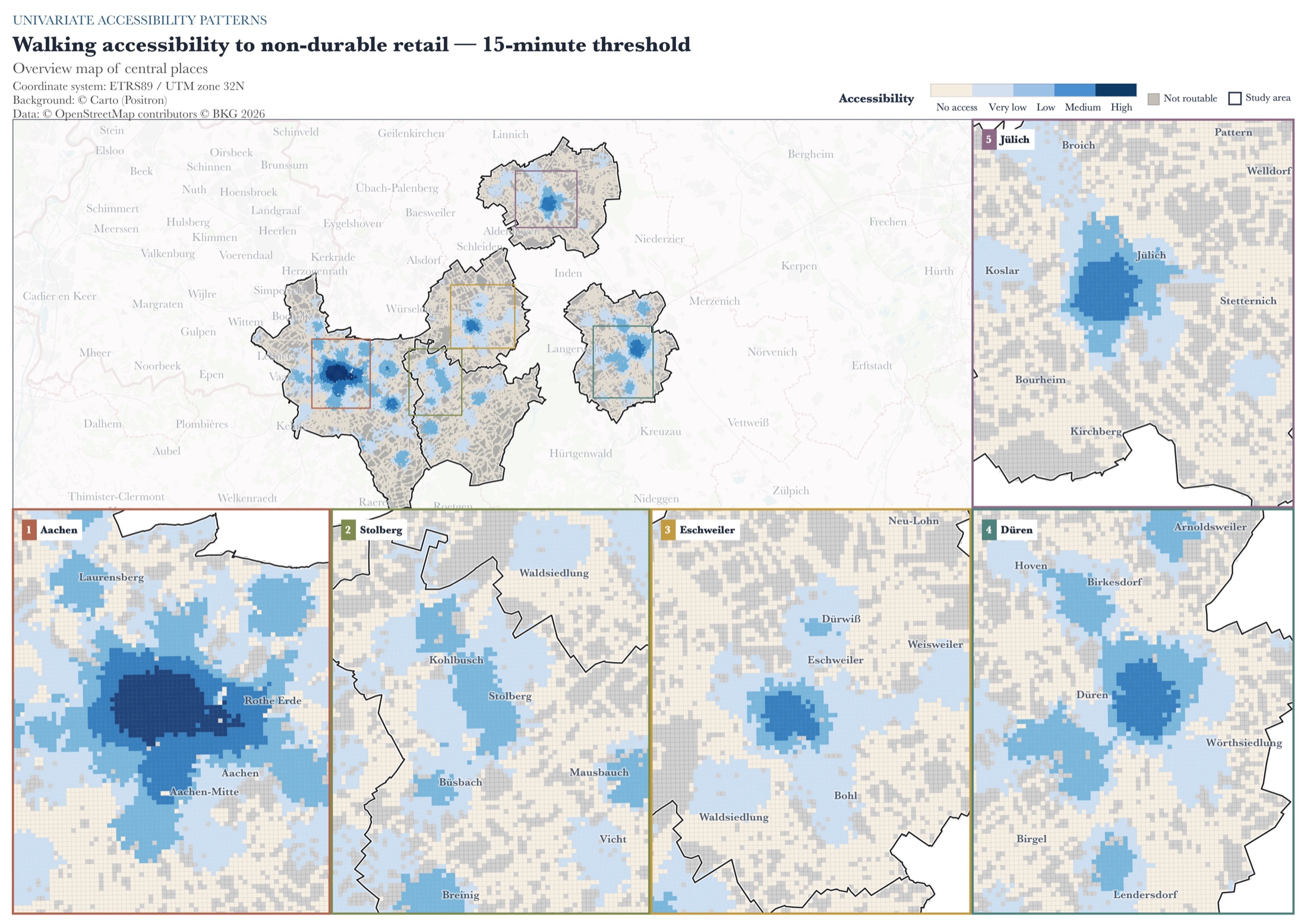
Across the five cities, 46 to 75% of routable cells have no non-durable retail destination within 15 minutes on foot. Population weighting narrows the gap, but 6.6% of Aachen residents and around 30% in the more dispersed smaller cities remain outside that modelled walking catchment.
Cycling expands the catchment
Cycling increases the share of residents with access to at least one non-durable store by 5.2 to 18.6 percentage points, with the largest gains in the smaller and more dispersed cities.
Car access can hide spatial differences
Car access to non-durable retail is available from 98 to 100% of routable cells under the modelled 15-minute threshold. That broad potential reach does not mean equal experienced access, because the model does not measure vehicle ownership or the ability to drive.
Socioeconomic associations are mode-dependent
Owner-occupier rate is negatively associated with accessibility in every city, retail category and mode. The association is generally weaker for car than for non-car modes. These are area-level spatial associations, not individual or causal effects.
Selected maps
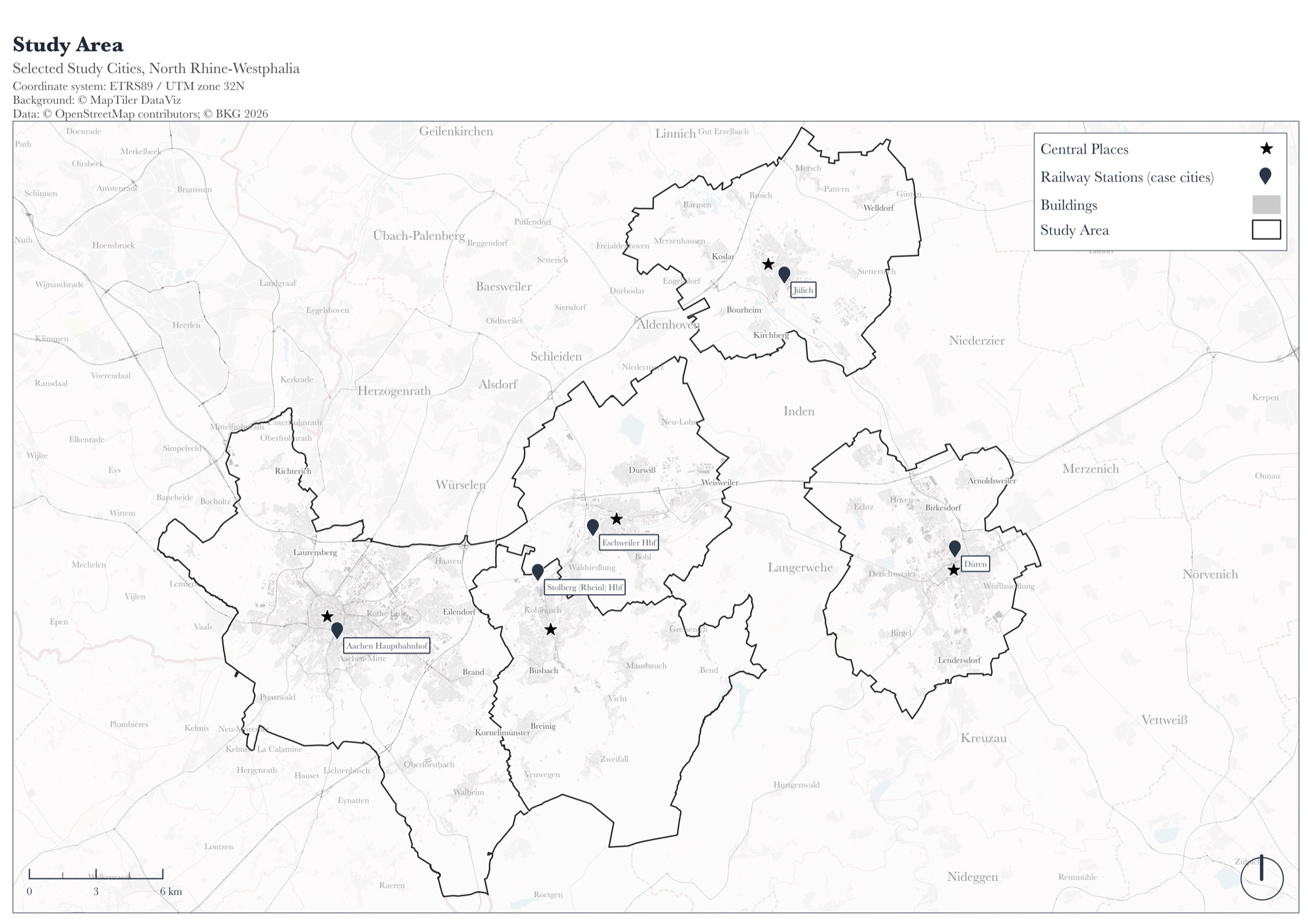
Five case cities in the Aachen region.
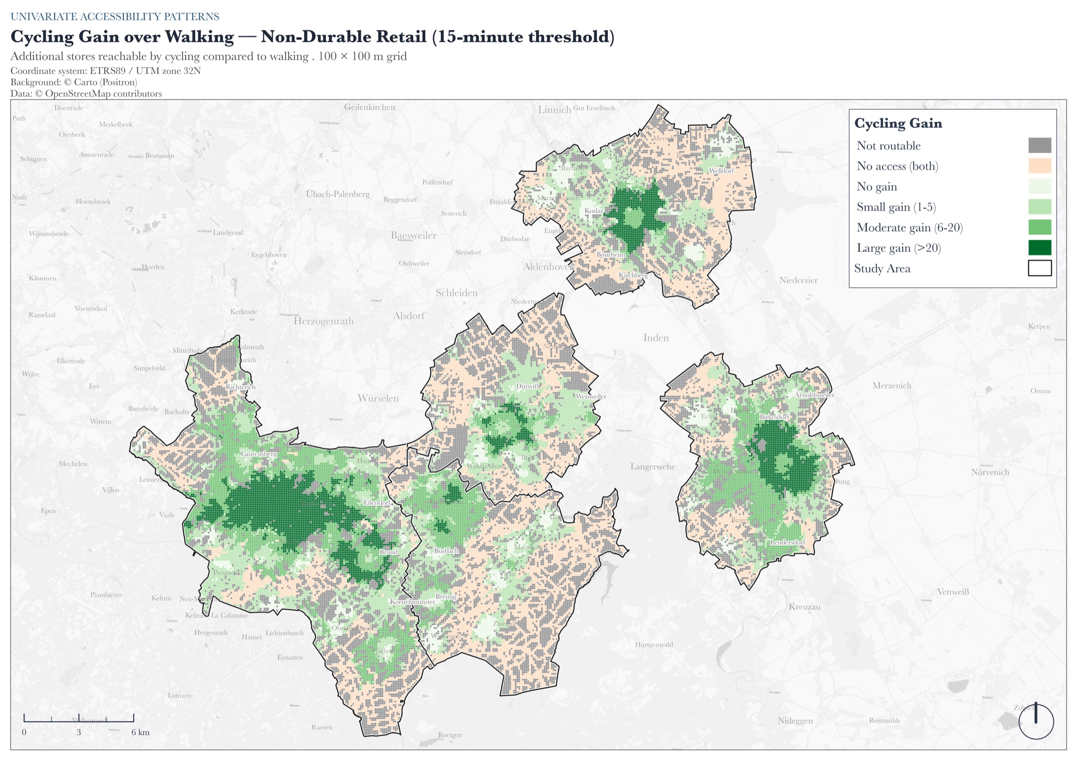
The largest gains occur in peri-urban transition zones.
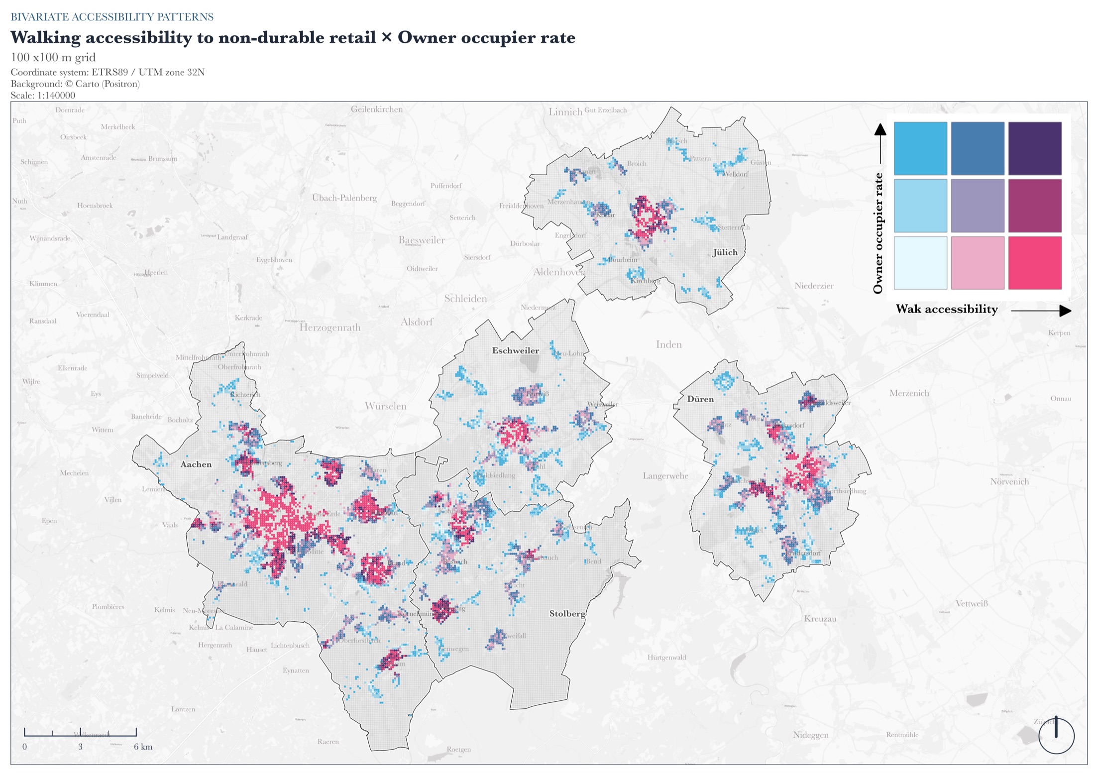
High walking access overlaps with lower owner-occupier rates in dense centres.
Technical stack
Client project maps are not shown here. The figures on this page are thesis maps created for this academic project.