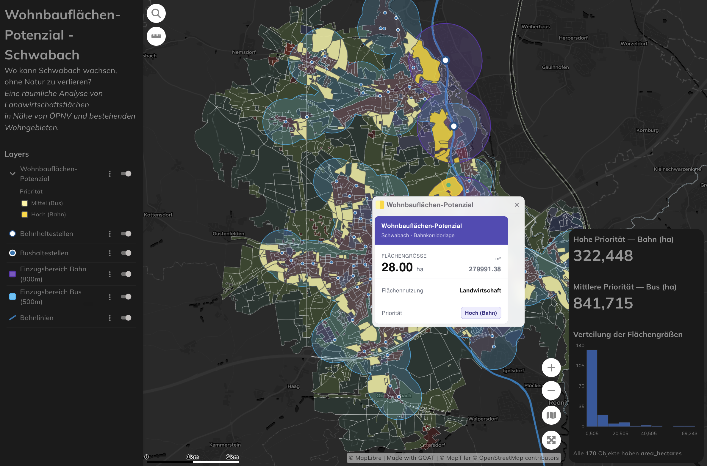
Overview
A multicriteria spatial analysis identifying farmland parcels around Schwabach, Bavaria (population ~40,000) that could feasibly accommodate housing development. The work addresses the tension between housing demand and farmland preservation — mapping land that is transit-accessible, adjacent to existing residential areas, geometrically suitable, and not forested, using only open-source data.
The analysis was published as a Plan4Better blog post and is fully replicable for any German municipality with ALKIS coverage and published GTFS feeds.
Key Findings
- 322 hectares of rail-priority buildable farmland identified
- 842 hectares of bus-priority buildable farmland (upper-bound estimate)
- All data sources open and publicly available — ALKIS, GTFS, OSM
- Workflow replicable for any German municipality by adjusting AGS code and thresholds
Methodology
Transit Accessibility Filter
Applied 800 m buffers around rail stations and 500 m buffers around bus stops, following BBSR and VDV planning guidelines. Rail-adjacent sites were given higher priority, as rail infrastructure tends to be more durable than bus routes over planning horizons.
Housing Adjacency Filter
Retained only parcels within 100 m of existing residential areas to encourage infill development rather than greenfield sprawl at the urban fringe.
Parcel Geometry Filter
Applied a minimum parcel size of 0.5 hectares and a Polsby-Popper compactness score above 0.3 to exclude elongated or irregularly shaped slivers that would be impractical to develop.
Forest Exclusion
Removed all forested areas in line with the Bundeswaldgesetz, ensuring only genuine farmland parcels remained in the output.
Data Sources
- ALKIS land-use parcels — Bayern Geoportal
- GTFS transit stops — DELFI Germany
- OpenStreetMap rail lines
Tools & Technologies
- GOAT (Plan4Better) — spatial analysis, multicriteria filtering and map visualisation
- ALKIS, GTFS (DELFI), OpenStreetMap — open data sources
- Polsby-Popper compactness scoring for parcel geometry filtering
Limitations
The analysis identifies spatial suitability only — land ownership and seller willingness remain major practical barriers in German land-use planning. Transit proximity uses straight-line buffering rather than actual walkable catchments shaped by street networks and topography. Bus-stop frequency data was not incorporated, making the 842 ha figure an upper-bound estimate.
Outcome
Delivered a transparent, open-data-based land suitability analysis that gives planners in Schwabach a clear spatial picture of where farmland could realistically support new housing — and a replicable workflow that can be adapted for other Bavarian and German municipalities.