Overview
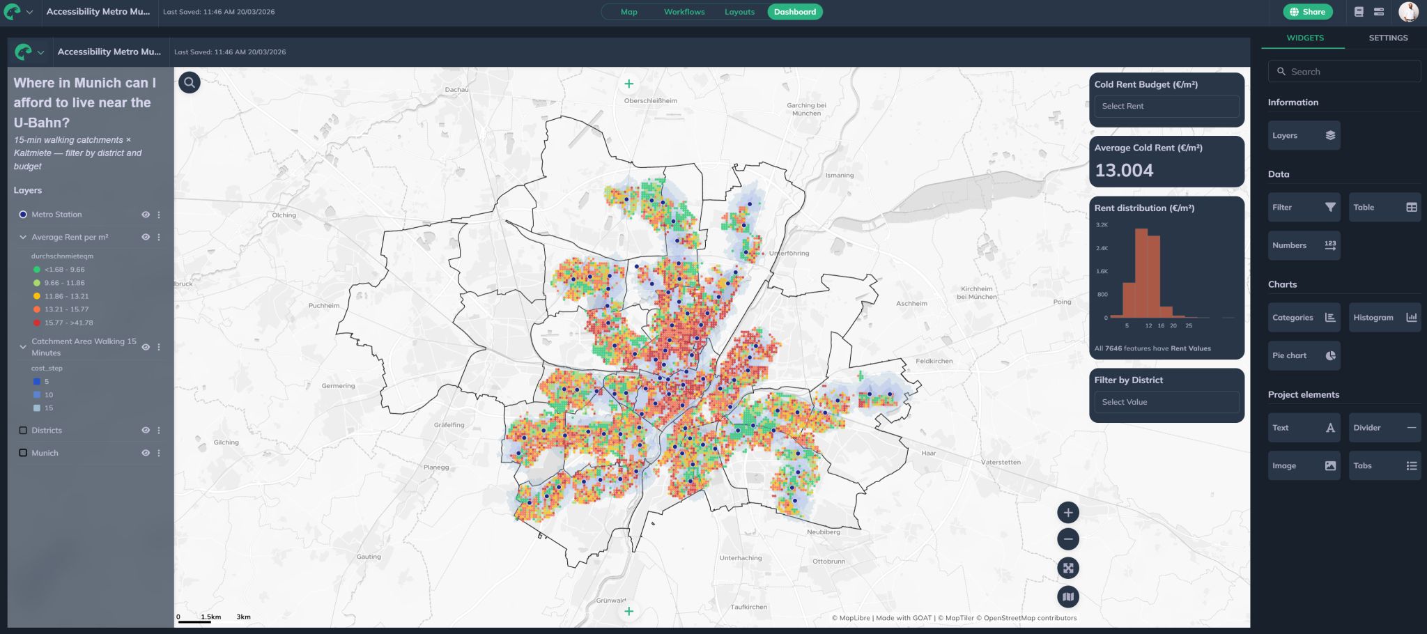
This project explores where relatively affordable rental areas in Munich overlap with 15-minute walking access to U-Bahn stations. It was developed in GOAT using the Workflows feature, creating a browser-based spatial analysis and dashboard without relying on a traditional desktop GIS workflow.
The aim was to support a practical urban planning question: which areas of Munich offer a better combination of rental affordability and public transport accessibility? The final dashboard allows users to explore rent levels, district patterns, and walking access to U-Bahn stations in one interactive map-based view.
Methodology
Data Preparation
Prepared Munich U-Bahn station data, postcode and district boundaries, and Zensus 2022 average cold rent grid data for spatial analysis inside GOAT.
Accessibility Analysis
Created 15-minute walking isochrones around Munich U-Bahn stations using GOAT routing to identify areas within practical walking access of the metro network.
Workflow Automation & Dashboard
Built reproducible GOAT Workflows to clip, process, and join the spatial layers, then visualised the final results in an interactive dashboard with district and rent-budget filtering.
Tools & Technologies
- GOAT Workflows for browser-based spatial analysis automation
- GOAT routing for 15-minute walking isochrones
- GOAT dashboard tools for interactive map-based visualisation
- Munich U-Bahn station data
- Zensus 2022 average cold rent grid data
- Postcode and district boundary layers
Outcome
The final dashboard shows where lower-rent areas intersect with strong U-Bahn walking accessibility in Munich. It provides a clear spatial evidence base for discussions around housing affordability, public transport access, and integrated urban planning.
Interactive Dashboard
Explore the live interactive version of this dashboard on the GOAT platform:
Open Interactive Dashboard