Overview
Inspired by the Johannesburg Spatial Planning Framework 2040 and guidance from Spatial Thoughts, this project conducts an intersection density analysis for Melbourne as a measure of walkability. Intersection density — the number of street intersections within a given area — is a key indicator of pedestrian connectivity, directly shaping how people move through a city on foot.
Why Intersection Density?
- Enhanced Connectivity — Higher intersection density allows shorter walking distances between destinations, creating a more connected community
- Safety and Comfort — Well-connected neighbourhoods with dense intersections provide safer and more comfortable pedestrian experiences
- Vibrant Street Life — Intersections serve as social hubs, fostering a livelier sense of community
Methodology
Pedestrian Network Data
Loaded Melbourne's pedestrian network GeoJSON from the Melbourne Open Data Platform to form the base street layer for intersection counting.
Land Use Areas (CLUE)
Integrated Small Areas for Census of Land Use and Employment (CLUE) GeoJSON data from Melbourne Open Data Platform to define the spatial units for density calculation.
Intersection Density Calculation
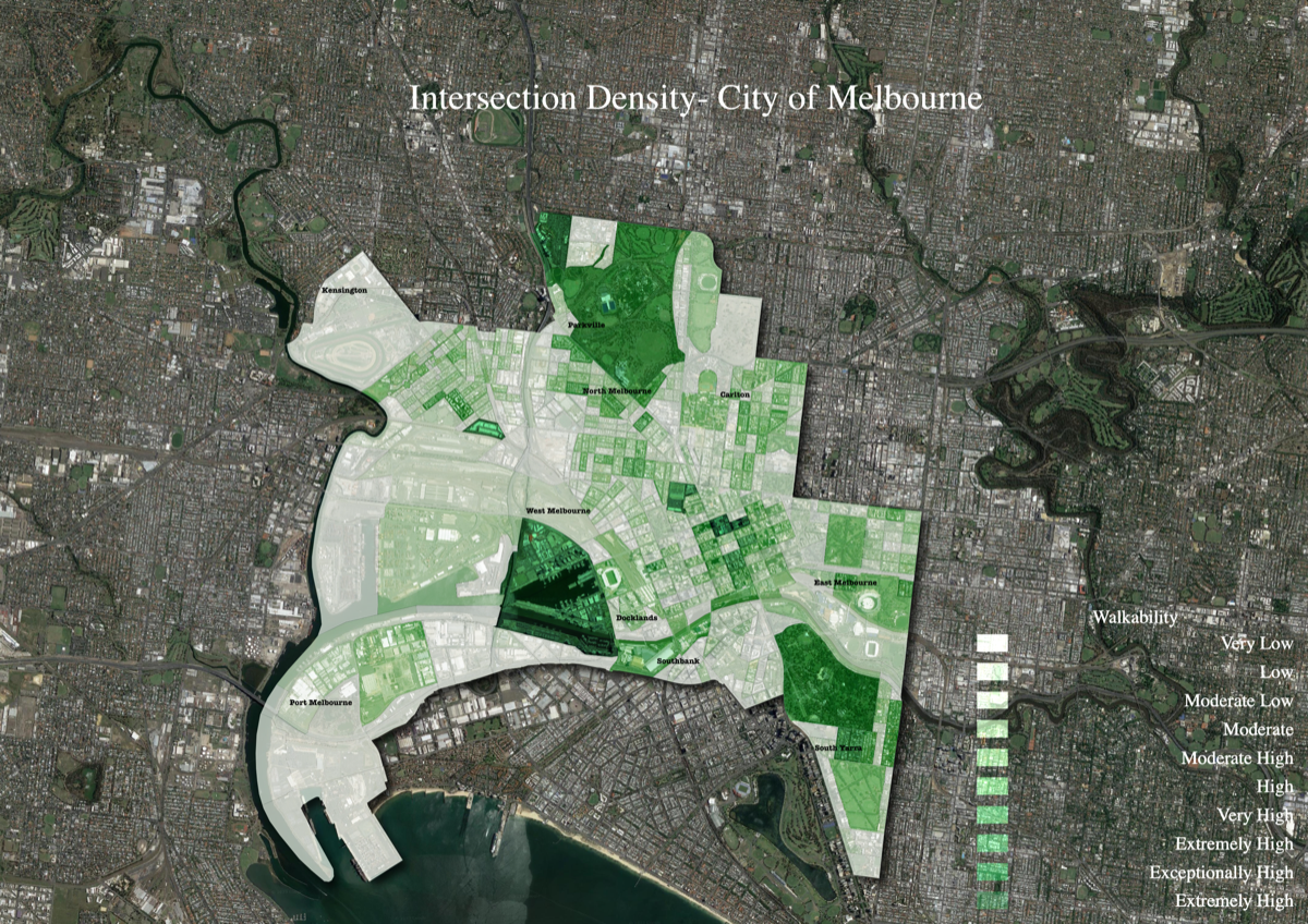
Calculated the number of street intersections per CLUE area using GIS spatial analysis, producing a density surface that reveals walkable and less walkable parts of Melbourne.
Data Sources
- Pedestrian Network GeoJSON — Melbourne Open Data Platform
- CLUE (Small Areas for Census of Land Use and Employment) GeoJSON — Melbourne Open Data Platform
- Methodology inspired by Spatial Thoughts and the Johannesburg Spatial Planning Framework 2040
Outcome
Produced an intersection density map for Melbourne that quantifies walkability across the city's land use areas, equipping urban planners and policymakers with spatial evidence for creating more pedestrian-friendly, liveable neighbourhoods.