Overview
An active mobility concept (Nahmobilitätskonzept) for Allach-Untermenzing, a growing district of Munich, commissioned by the City of Munich. Following "15-minute city" principles, the project develops a sustainable mobility strategy tailored to the district, combining data-based analysis of walking, cycling and public transport infrastructure with stakeholder engagement and local community involvement.
The project is delivered by a consortium of Sweco GmbH (infrastructure planning and engineering) and Plan4Better GmbH (data-based mobility planning and accessibility analysis). I carried out the accessibility analysis across all three transport modes and produced the cartography for the project, working alongside colleagues at Plan4Better and the Sweco team.
Client: Stadt München · Period: 2024–2026
View on Plan4Better ↗Workflow
Follow the process. Expand a step for the details.
01Fine-Grained Data Collection
Systematic collection and analysis of pedestrian and cycling path availability, width, surface condition, traffic safety and accessibility for people with disabilities, including on-site inspections across the district.
02Multimodal Accessibility Analysis
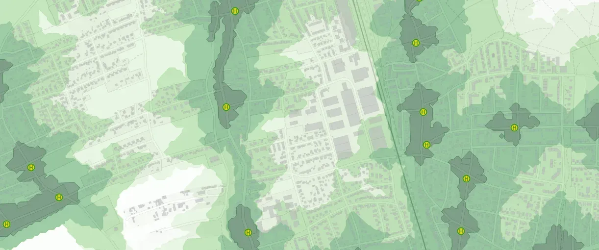
Detailed accessibility analysis across walking, cycling and public transport, mapping catchments for the full service window (6am–8pm) to understand how well the district is served throughout the day.
03Deficiency Identification & Stakeholder Engagement
Data-based localisation of weak points in the existing pedestrian and cycling networks, combined with citizen participation through the city's platform, public events and walkability checks.
04Measure Development
Development of concrete, actionable mobility measures based on the analyses and citizen feedback, including cost estimates and an implementation strategy.
Key Work Areas
- Fine-grained data collection on pedestrian and cycling infrastructure quality
- Accessibility analysis for pedestrian, cycling and public transport modes
- Identification of deficiencies in existing walking and cycling networks
- Stakeholder engagement through the city's participation platform, public events and walkability checks
- Measure development and implementation strategy, including cost estimates
Goals & Results
- A comprehensive, sustainable mobility concept tailored to Allach-Untermenzing and transferable to comparable Munich districts
- Improved local mobility infrastructure, focused on optimised cycling connections, safe pedestrian paths and better public transport connections
- Transparent communication channels and structured participation processes built around resident expertise on local mobility needs
Tools & Technologies
- GOAT (Plan4Better) — multimodal accessibility analysis and cartographic output
- Fine-grained pedestrian and cycling infrastructure data (width, surface, safety, accessibility)
- Public transport accessibility catchments (6am–8pm service window)
- Land-use data for Allach-Untermenzing
Outcome
An ongoing active mobility concept that gives the City of Munich a data-driven, resident-informed picture of walking, cycling and public transport accessibility in Allach-Untermenzing — identifying concrete deficiencies and a prioritised set of measures to make everyday mobility safer and more sustainable, with an approach transferable to other growing Munich districts.