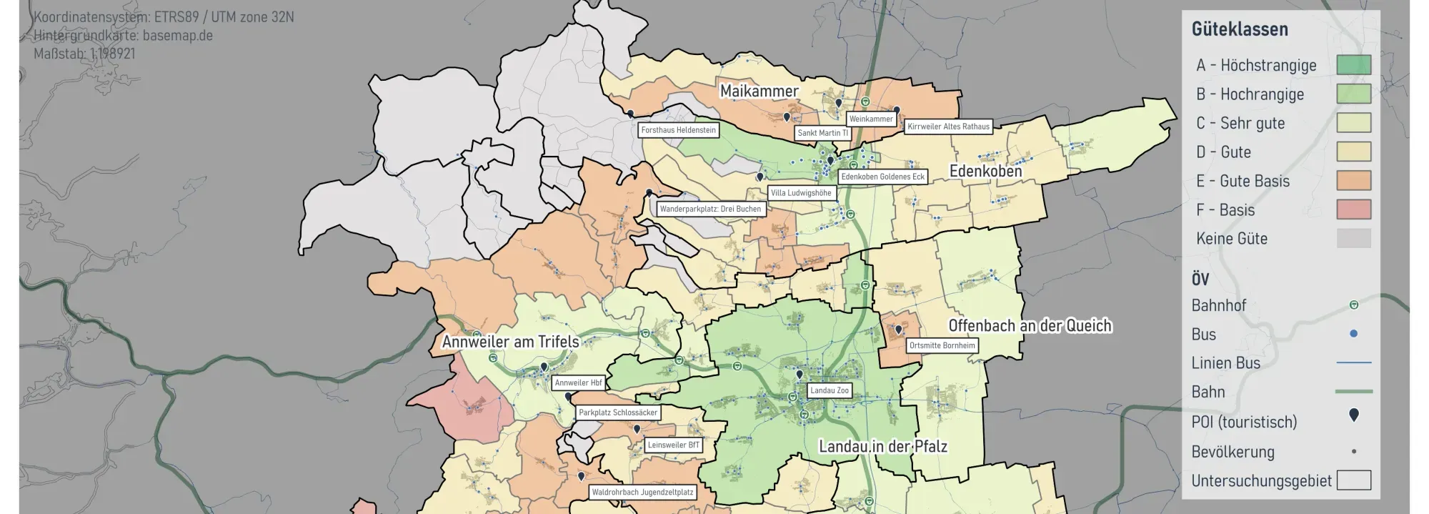
Overview
A public transport (ÖPNV) accessibility study for the District of Südliche Weinstraße and the city of Landau, commissioned by the district as part of the Rhine-Neckar region's Smart Region initiative. The study examined how well tourist destinations in the area are served by public transport, identifying general and tourism-specific strengths and weaknesses in the transit offer.
I carried out the accessibility and gap analysis and produced all cartography for the project, working alongside other colleagues at Plan4Better on data preparation and the visitor survey evaluation.
Client: District of Südliche Weinstraße · Period: 2025
View on Plan4Better ↗Workflow
Follow the process. Expand a step for the details.
01Transit & On-Demand Data Integration
Combined classical line-based public transport with VRNflexline, the on-demand service operating in parts of Südliche Weinstraße, so the analysis reflects the full transit offer available to residents and visitors.
02POI Accessibility Analysis
Assessed public transport accessibility to 19 selected tourist points of interest, comparing travel times by public transport against motorised individual transport (MIV) to each destination.
03Visitor Survey Integration
Incorporated the results of a visitor survey conducted at several POIs, grounding the accessibility findings in how tourists actually experience getting to these destinations.
04Gap Analysis & Measure Catalogue
Synthesised the findings into a gap analysis of the transit offer and developed a catalogue of measures to improve public transport quality across the district.
Travel Time Comparison
Comparing travel times by public transport against motorised individual transport to each tourist destination highlighted where transit is competitive and where the gap is widest.
Deliverables
- Fact sheets for 19 selected tourist POIs, each showing accessibility by different transport modes
- Municipality-level map of public transport quality classes (Güteklassen A–F), combining transit stops, bus and rail lines, tourist POIs and population
- Gap analysis of the district's public transport offer, including tourism-specific weaknesses
- Catalogue of measures to improve public transport quality in Südliche Weinstraße
- Cartography for all maps and fact sheets produced for the study
Tools & Technologies
- GOAT (Plan4Better) — accessibility engine and cartographic output
- GTFS / line-based public transport data combined with VRNflexline on-demand service data
- Travel-time comparison between public transport and motorised individual transport
- Visitor survey data for tourism-specific evaluation
Outcome
Delivered an accessibility study that gives the District of Südliche Weinstraße a clear, evidence-based picture of how well tourist destinations are served by public transport — including the district's on-demand service — and a concrete catalogue of measures to close the gaps identified, as part of the Rhine-Neckar region's Smart Region initiative.