Overview
Custom QGIS Actions to enable interactive neighbour lookups directly from the map canvas. Clicking a feature triggers a Python action that finds and highlights all adjacent features, enabling quick spatial relationship exploration without running separate analysis tools.
Methodology
Action Configuration
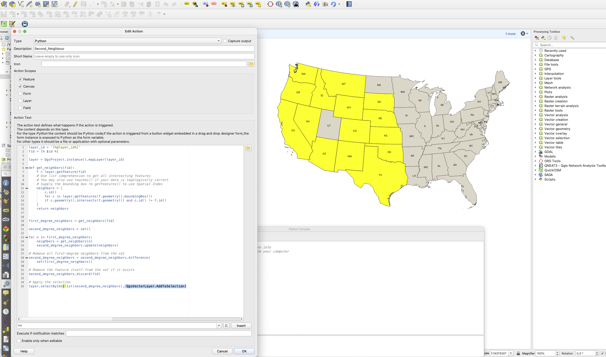
Configured QGIS Layer Actions using the Python action type to intercept feature clicks on the map canvas.
Neighbour Query Logic
Wrote Python expressions within the action to query spatially adjacent features using QGIS's spatial predicates (touches, intersects) and highlight results on the canvas.
Attribute Display
Configured the action to also open a summary panel showing neighbour attributes for quick inspection.
Tools & Technologies
- QGIS Layer Actions framework
- PyQGIS for spatial query logic
- QGIS Expression Engine
Outcome
Created a reusable QGIS action enabling interactive neighbour lookups without additional tooling, showcasing advanced QGIS customisation and PyQGIS scripting skills.