Objective
This project tests a transparent, four-class land-cover workflow for Munich: urban / built-up, bare / open land, water and vegetation. The goal is a concise, reproducible remote-sensing workflow rather than an authoritative production land-cover product.
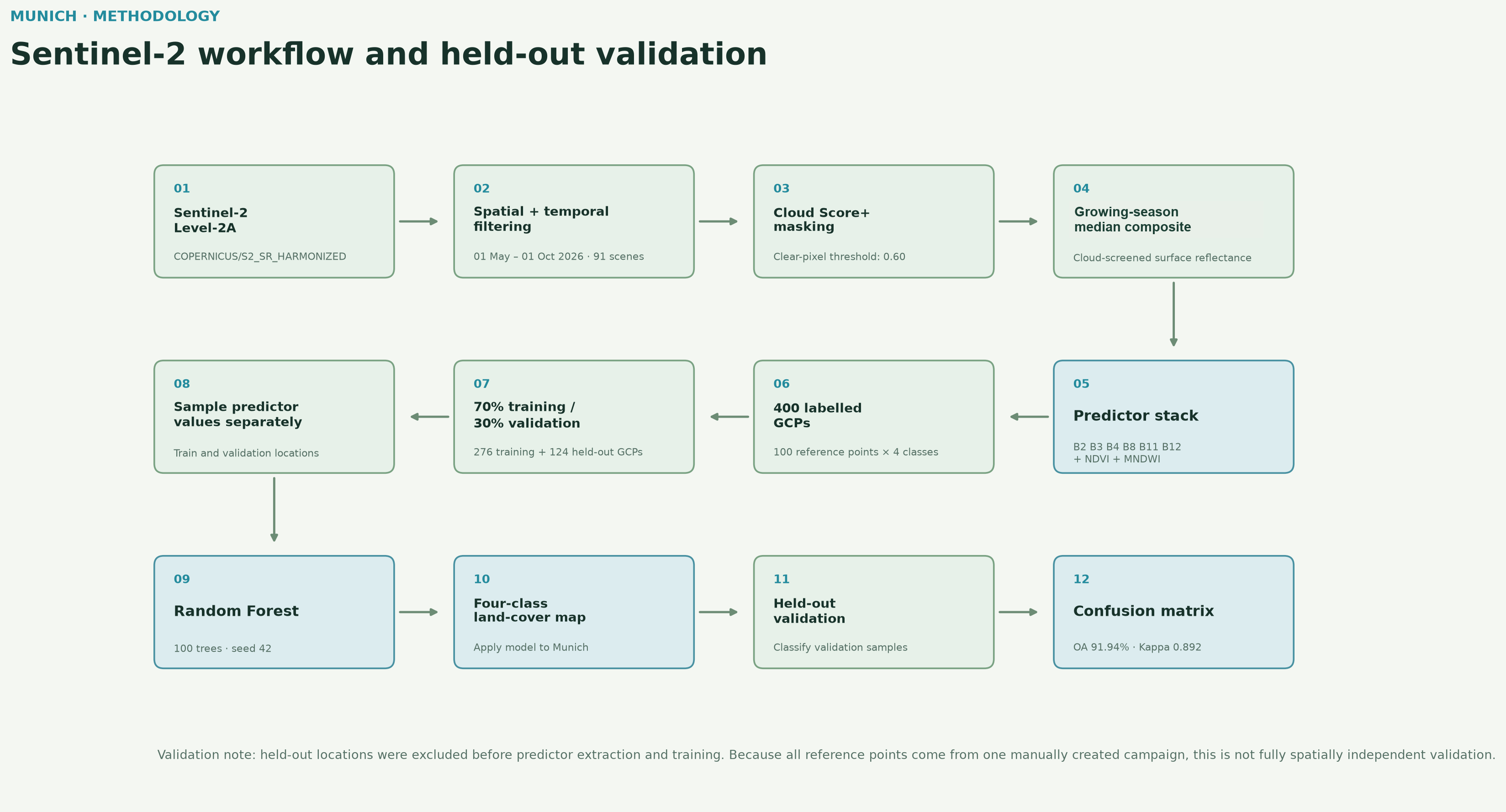
Data. COPERNICUS/S2_SR_HARMONIZED Level-2A surface reflectance from May–September 2026 (91 scenes before compositing), cloud-screened with Google Cloud Score+ at a 0.60 clear-pixel threshold and aggregated as a growing-season median composite. The predictor stack combines B2, B3, B4, B8, B11, B12, NDVI and MNDWI.
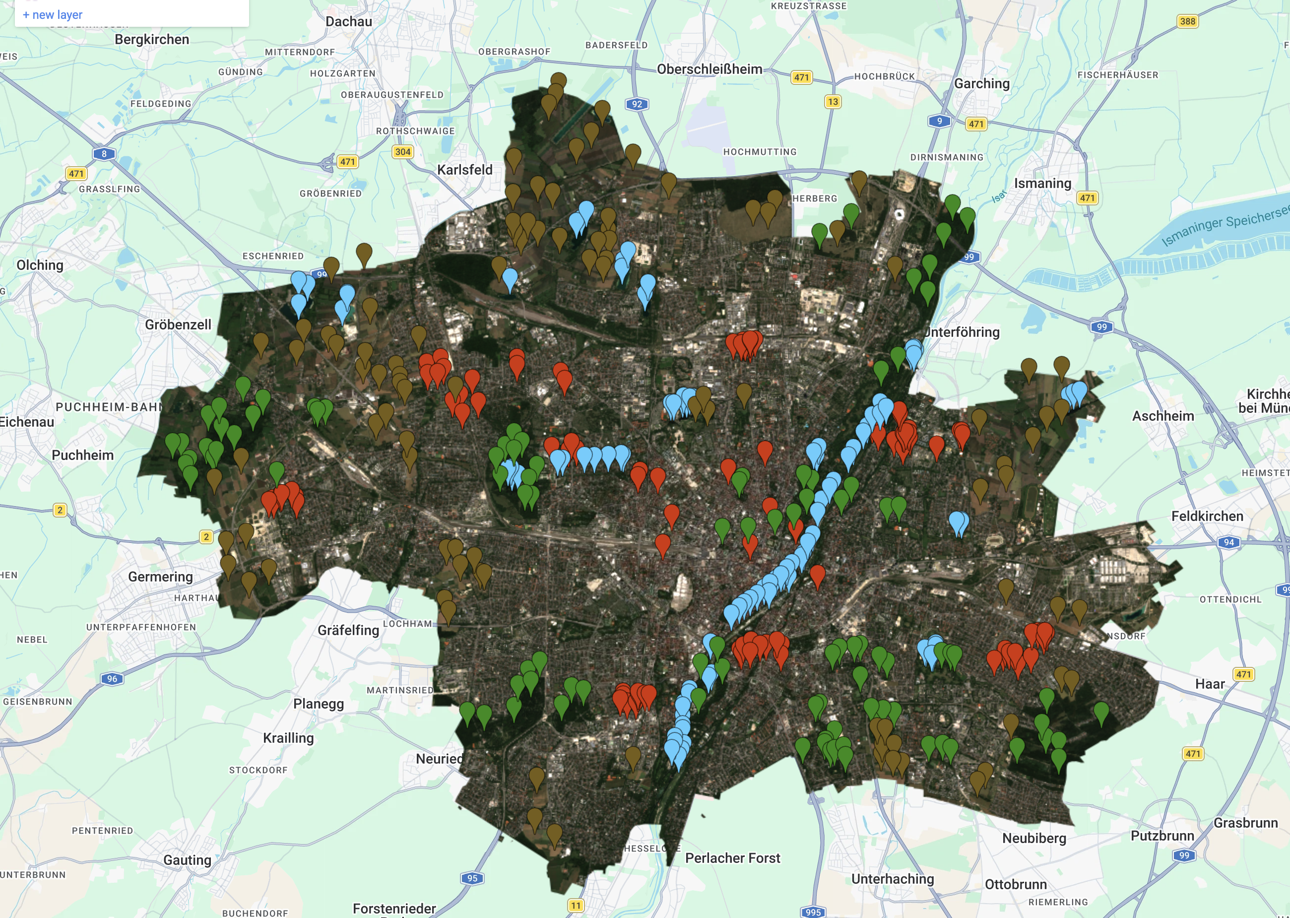
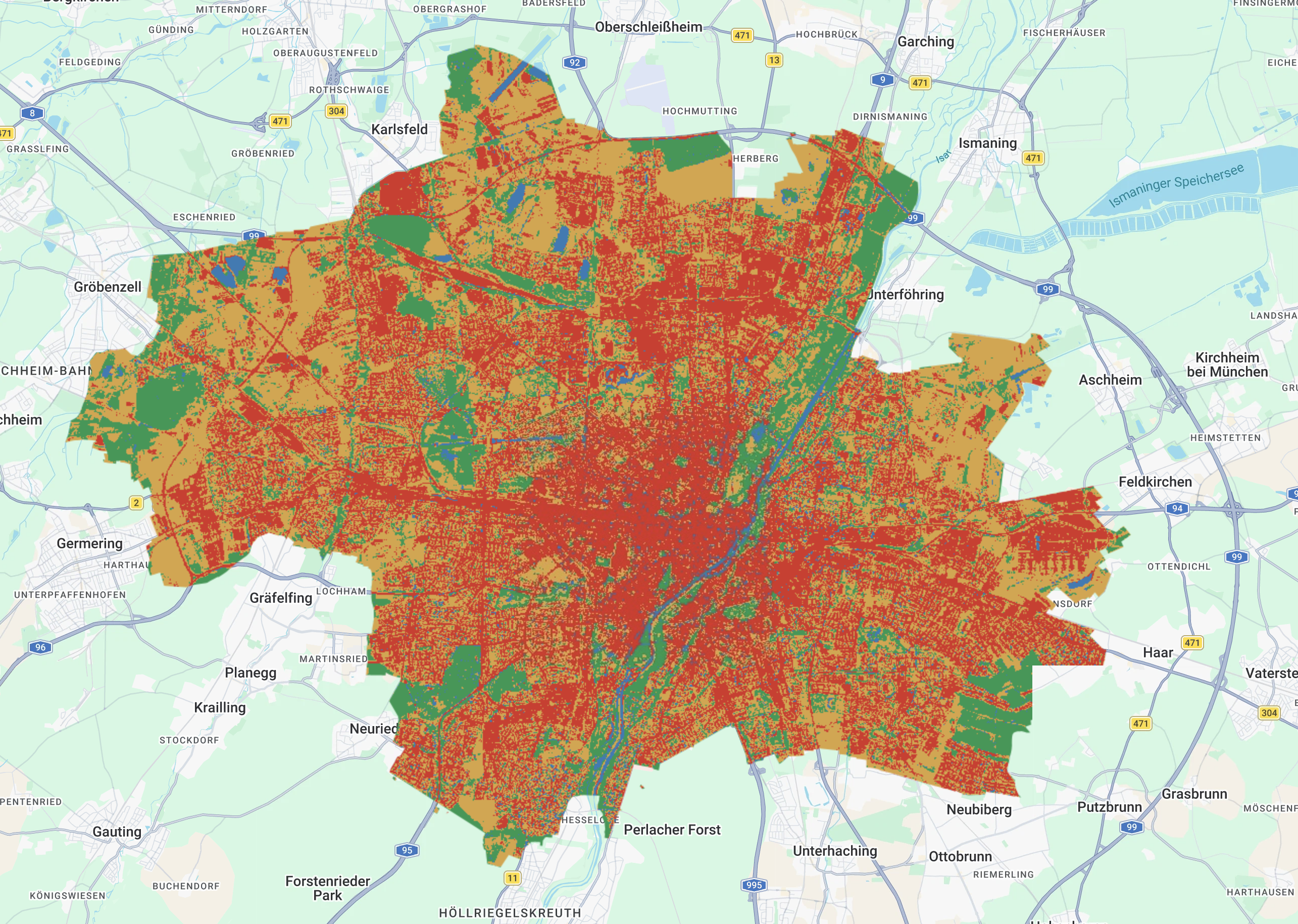
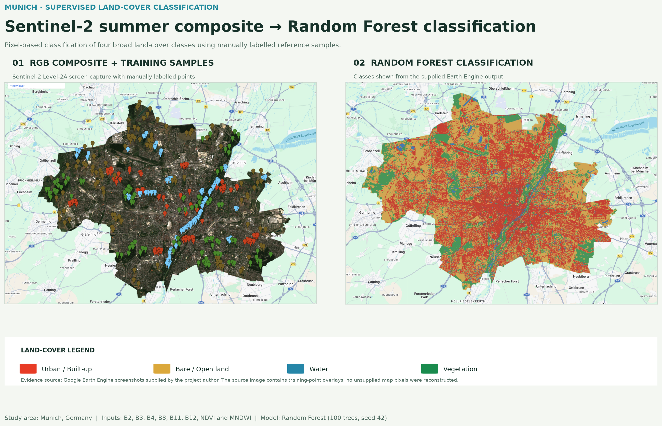
RGB composite and classified map
The comparison below presents the supplied Earth Engine outputs with a portfolio-ready legend. The RGB source capture includes the manually labelled sample overlay; it has not been replaced with invented imagery.
Method
Four land-cover classes were represented by 100 manually labelled reference points each. The 400 reference points were randomly divided into 276 training and 124 validation locations before Sentinel-2 predictor values were extracted. A 100-tree Random Forest with seed 42 was trained on the sampled training locations only.
Accuracy assessment
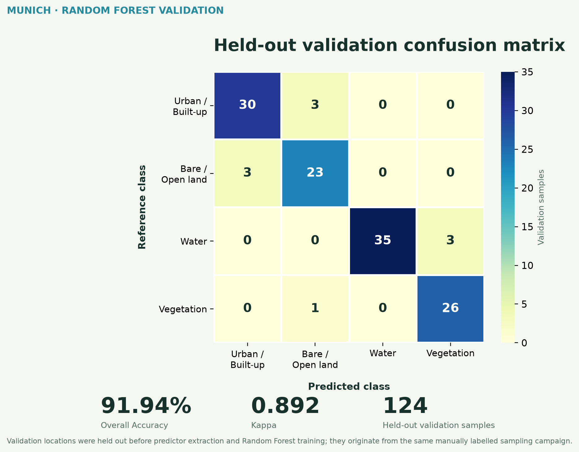
| Class | Producer Accuracy | User Accuracy |
|---|---|---|
| Urban / Built-up | 90.9% | 90.9% |
| Bare / Open Land | 88.5% | 85.2% |
| Water | 92.1% | 100.0% |
| Vegetation | 96.3% | 89.7% |
Model refinement
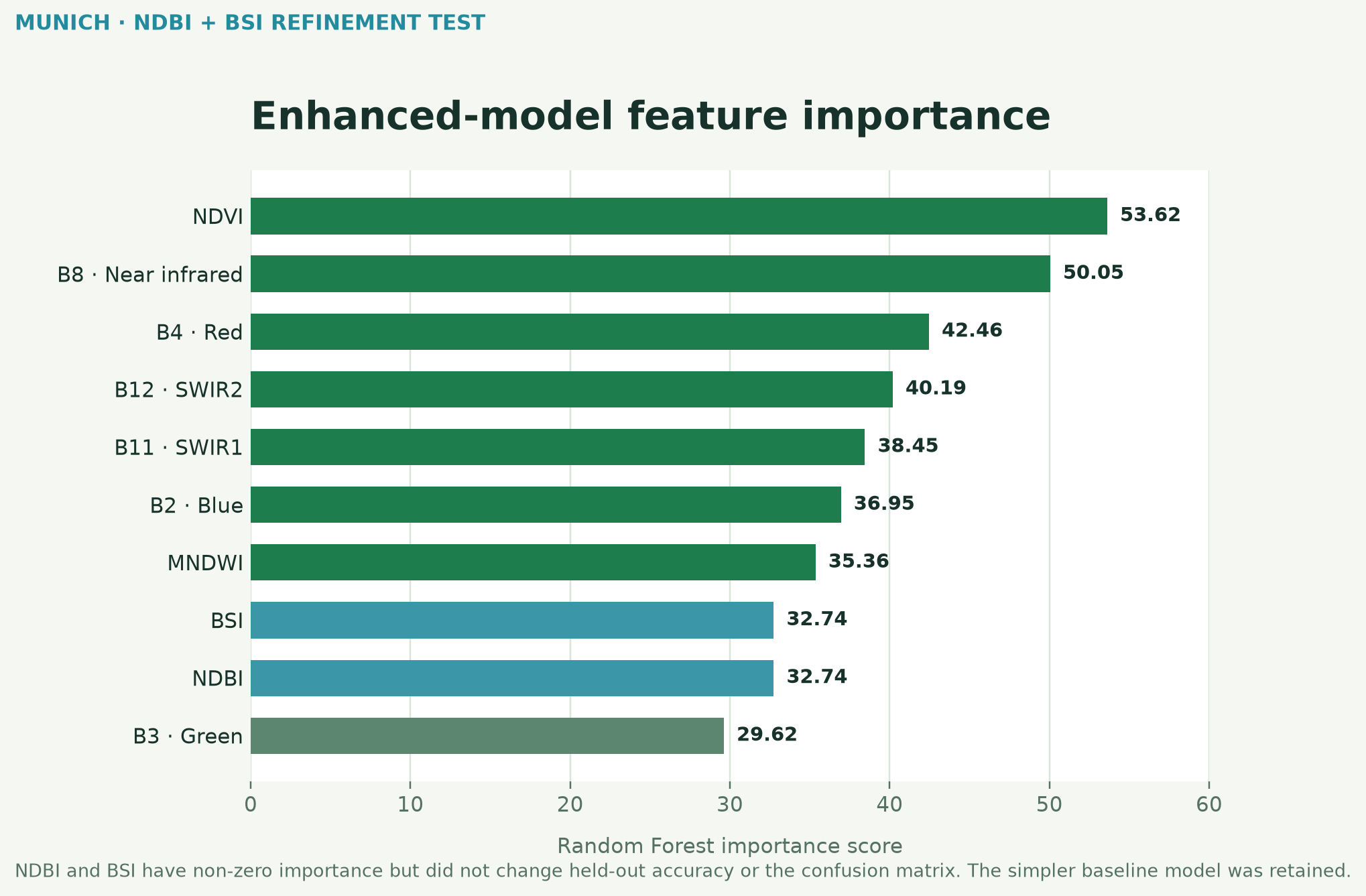
To address the urban–bare / open land confusion, NDBI and BSI were tested as additional predictors. Both received measurable Random Forest importance, but neither the held-out accuracy nor the confusion matrix changed. The simpler baseline model was therefore retained.
| Metric | Baseline | Enhanced |
|---|---|---|
| Predictors | 8 | 10 |
| Overall Accuracy | 91.94% | 91.94% |
| Kappa | 0.892 | 0.892 |
| Additional indices | — | NDBI, BSI |
| Out-of-bag error | — | 10.1% |
| Final choice | Retained ✓ | Not retained |
Interpretation
The strongest reciprocal confusion occurs between urban and bare / open land. Three urban reference samples were predicted as bare / open land, while three bare / open samples were predicted as urban. Water and vegetation show stronger separation, although three water validation samples were classified as vegetation. Vegetation achieved the highest producer accuracy at approximately 96.3%, while water achieved 100% user accuracy in the held-out validation sample. Fine-grained salt-and-pepper variation remains visible because this is a pixel-based classification without post-classification smoothing.
Limitations and tools
The reported accuracy is based on a random holdout of the original manually labelled reference points. The validation samples were excluded before predictor extraction and model training. However, because the training and validation locations originate from the same manually created sampling campaign and may be spatially close, the result should not be interpreted as a fully spatially independent accuracy assessment. A production workflow would use geographically independent validation data or external reference imagery.
Google Earth Engine · Sentinel-2 Level-2A · Cloud Score+ · Random Forest · JavaScript · Python · Matplotlib
Learning attribution: methodology informed by the Spatial Thoughts End-to-End Google Earth Engine course by Ujaval Gandhi.