Published professional project
During my GIS internship at Plan4Better, I contributed to accessibility and walkability analyses for the City of Augsburg. The work is now published as an official Plan4Better reference. It assessed public-transport access and the pedestrian-friendliness of streets and paths in the Rechts der Wertach neighbourhood.
The objective was to give the city a spatially differentiated evidence base for improving sustainable mobility, accessibility and quality of life.
Two complementary analyses
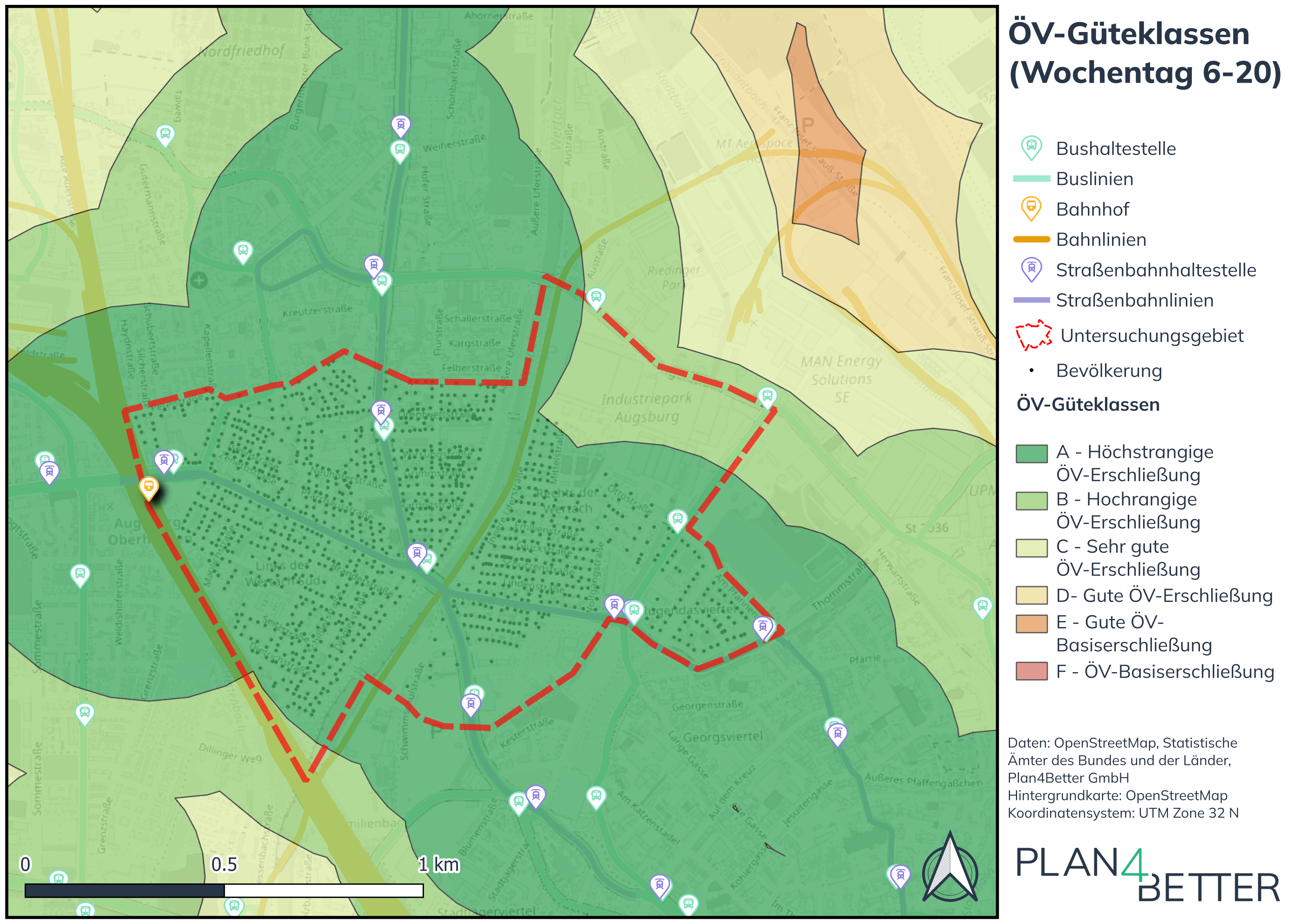
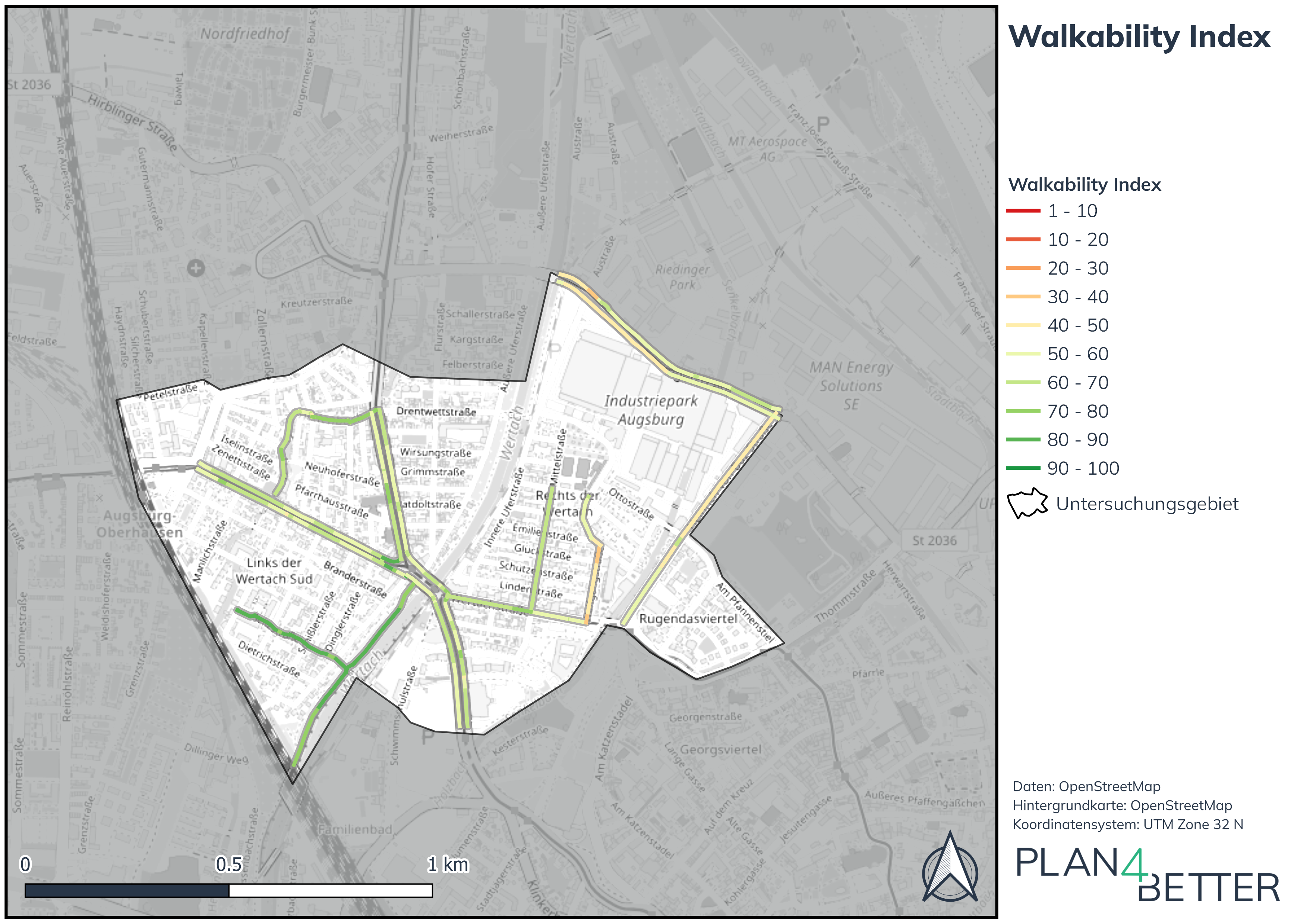
ÖV-Güteklassen, modelled on the Swiss approach, make the relationship between walking access to stops and the frequency of public-transport service visible. The Walkability Index evaluates the pedestrian environment for different user groups and helps identify where walking conditions can be improved.
Data and local context
The project combined user-generated geodata for the street network with official land-use data, 3D building data and digital terrain models. GTFS timetable data supported public-transport analysis; POI data represented destinations for daily needs, public services and recreation. Street imagery from Mapillary was used to represent local conditions.
Where data gaps affected variables such as lighting, crossings or accessibility, the project team supplemented them through on-site surveys and, where possible, contributed the information back to OpenStreetMap and Mapillary.
Implementation in GOAT
The analyses were produced in GOAT, mapped and interpreted with experienced urban and transport planners at Plan4Better, then compiled into a report for the City of Augsburg.
Planning value
The combined perspective shows where public transport is well integrated with walking access and where street and path conditions require attention. It gives the City of Augsburg concrete, place-based evidence for future measures in Rechts der Wertach and provides a pilot approach that can be applied to further neighbourhoods.
Official publication
The public Plan4Better reference provides the authoritative project description and places the work within Augsburg’s mobility goals.
View the Plan4Better reference ↗
Professional project by Plan4Better GmbH for the City of Augsburg. Maps reproduced from the published project material.