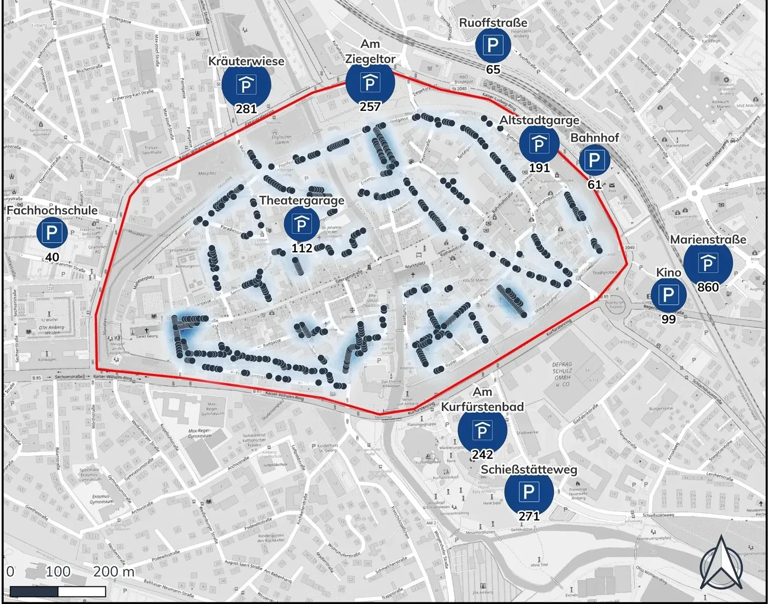
Overview
Two accessibility reports for the City of Amberg and its historic city centre, built with GOAT. The first report examined how accessible various destinations in Amberg's city centre are from the available parking facilities. The second analysed and compared different variants of a planned new cycle path connection, "Höchste Eisenbahn."
The parking report answered four questions: how well public parking garages and on-street parking are served by car; how well the Marktplatz is served by bicycle; how walkable various points of interest are from parking facilities; and where gaps remain in the parking offer. The cycle path report modelled the accessibility gain of the new connection for residents and key destinations, comparing a variant without an underpass against one with an underpass.
I carried out the accessibility analyses — on foot, by bicycle and by car — and produced the cartography for both reports.
Client: City of Amberg · Period: 2023–2024
View on Plan4Better ↗Workflow
Follow the process. Expand a step for the details.
01Parking Inventory
Mapped all inner-city parking garages, parking areas and on-street parking in Amberg's historic centre, including capacity per facility.
02Multimodal Accessibility Analysis
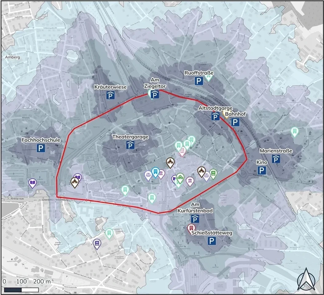
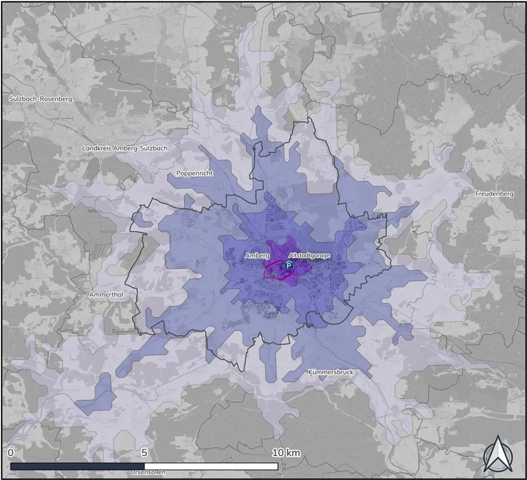
Analysed walking accessibility from parking facilities to key points of interest, cycling accessibility to the Marktplatz, and car accessibility to the Altstadtgarage from the wider region.
03Gap Identification
Identified gaps in the parking offer relative to demand and destination coverage across the city centre.
04Cycle Path Variant Comparison
Modelled the planned "Höchste Eisenbahn" cycle path and compared the accessibility gain for residents and POIs between a variant without an underpass and one with an underpass.
Walking Accessibility
Walking accessibility from the inner-city parking facilities to public buildings and points of interest, shown in 3/5/7/10-minute catchments.
Car Accessibility
Motorised private transport (MIV) catchments to the Altstadtgarage from the wider Amberg region, at 5/10/15/20-minute thresholds.
Cycle Path Analysis
For the planned "Höchste Eisenbahn" cycle path, the report compared the accessibility gain over the current situation for two variants: without an underpass, and with an underpass — quantifying how much better residents and key destinations would be served by each option.
Tools & Technologies
- GOAT (Plan4Better) — multimodal accessibility analysis and cartographic output
- Walking, cycling and car (MIV) catchment analysis
- Inner-city parking inventory and capacity data
- Scenario comparison for planned cycling infrastructure
Outcome
Delivered two accessibility reports that give the City of Amberg an evidence base for parking and cycling decisions in its historic centre — pinpointing gaps in the current parking offer and quantifying the accessibility benefit of a new cycle path connection under two design variants.